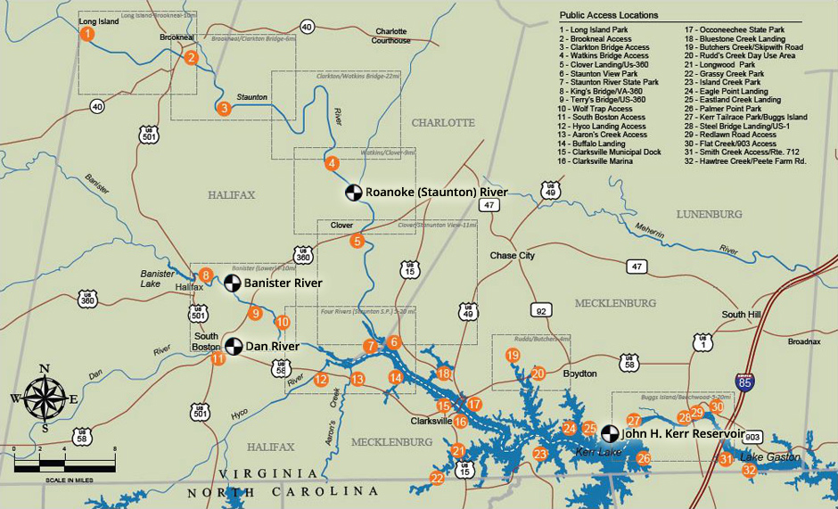
At normal levels, the rivers of the Southern Virginia Wild Blueway offer an enjoyable and family-friendly paddling experience. However, conditions can change quickly, so please use caution and check these links or click on the river gauge icons on the map below for accurate information. If you plan to enjoy the Blueway below the dam on Kerr Lake, you may call for a pre-recorded message regarding scheduled releases.

BANISTER RIVER AT HALIFAX, VA
http://waterdata.usgs.gov/va/nwis/uv?02077000
DAN RIVER AT SOUTH BOSTON, VA
http://waterdata.usgs.gov/va/nwis/uv?02076000
ROANOKE (STAUNTON) RIVER AT RANDOLPH, VA
http://waterdata.usgs.gov/va/nwis/uv?02066000
JOHN H. KERR RESERVOIR LEVEL (standard lake level is ~300ft-msl):
http://epec.saw.usace.army.mil/
JOHN H. KERR RESERVOIR RELEASE SCHEDULE (recorded message – no website available):
434-738-6371 x276


